
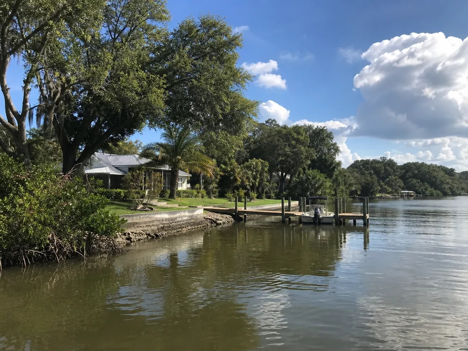
Alafia River and Bullfrog Creek watershed context
Parts of Gibsonton lie within Alafia River and Bullfrog Creek watershed areas that drain toward Tampa Bay. A watershed label explains regional water movement, but the private property's actual river, creek, canal, drainage, and shoreline conditions still need verification.
Drainage and downstream conditions belong in the discussion
Runoff paths, outfalls, low areas, bank erosion, sediment movement, tidal influence, upstream inputs, and downstream constraints can affect what is observed at a Gibsonton property. These factors should be documented without assuming one cause from appearance alone.
Separate bank, wall, dock, and lift questions
Eroding or unarmored banks lead to stabilization questions; movement in a retaining wall leads to seawall evaluation; an access structure may require dock guidance; and a boat lift needs vessel, support, clearance, water, and electrical information. Drainage observations can be relevant across several categories.
Start with the Gibsonton property and adjoining water
Share the property address and what you are seeing or planning. The waterfront contractor will verify the jurisdiction, adjoining waterbody, existing permits, and proposed scope before determining which Hillsborough County, EPC, Florida, or federal reviews may apply.
Official resources: Hillsborough County Development Services, EPC water and shoreline permits, and Florida environmental permitting.
Observe banks and drainage paths carefully
From stable areas, note washout, undercut banks, cracking, settlement, outfall flow, debris lines, loose dock components, and changes after rain or high water. Keep away from unstable slopes, contaminated discharges, swift water, and wet electrical equipment.
Build a useful Gibsonton property history
If available, keep the survey, drainage or utility records, prior waterfront permits and plans, repair history, and notes about rainfall, tides, water levels, or downstream changes ready. If the professional later requests photos, take pictures from stable ground.
What shapes a Gibsonton waterfront proposal
Drainage, bank stability, access, water conditions, environmental resources, structure, utilities, engineering, applications, inspections, materials, weather, and site discoveries influence scope, cost, and timing. Evaluation comes before a written project proposal.
Explore related Gibsonton waterfront services
Bank condition, runoff, outfalls, low areas, and downstream drainage determine whether shoreline stabilization, seawall, dock, or lift guidance best frames the concern. Start with the affected area, then carry the drainage history into the property evaluation.
Frequently asked questions
What water and drainage setting should I verify in Gibsonton?
You can point out where runoff, standing water, bank changes, or outfall flow appear on the property. The experienced professional handling your project will evaluate how the river, creek, canal, drainage path, and shoreline relate before drawing conclusions about the cause or appropriate work.
What should I record after rain or high water in Gibsonton?
From stable areas, document bank change, runoff, outfall flow, low spots, drainage paths, debris lines, wall or dock movement, and downstream changes. Do not approach unstable slopes, contaminated discharges, or swift water.
How do I determine the review layers for a Gibsonton waterfront project?
Your contractor will confirm the property record, jurisdiction, waterbody, existing permits, and scope before checking the applicable Hillsborough County, EPC, Florida, and federal review layers.
How do drainage and bank conditions shape a Gibsonton proposal?
Bank stability, runoff and drainage, outfalls, access, water conditions, environmental resources, structure, utilities, engineering, applications, inspections, materials, weather, and discoveries define the property specific scope.
Who performs the work?
Florida Waterfront Services manages your request and connection. The local professional evaluates the bank, drainage, and structure conditions, contracts directly with you, and performs any work you authorize.
Information reviewed August 2026. Permit and regulatory information was checked against current official sources.