
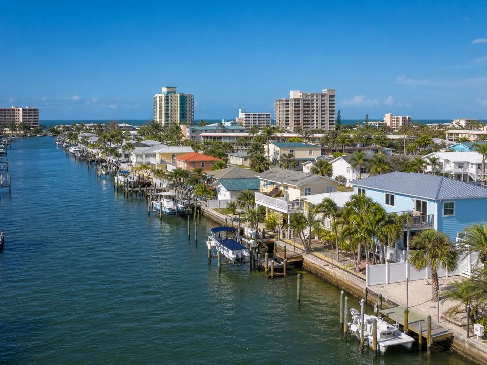
Boca Ciega Bay, finger canal, or Gulf facing context
Treasure Island properties can face Boca Ciega Bay, line narrow finger canals, or sit within a broader Gulf facing community context. Exposure, navigation space, vessel access, shoreline transitions, drainage, elevation, and construction access differ across those settings.
Chapter 69 shapes local marine structure questions
Treasure Island has local rules for docks, boat lifts, seawalls, and other marine structures. Depending on the work, the city may ask for details about projection, elevation, drainage, plans, or documents prepared by a Florida engineer. Your contractor will determine which requirements apply to your property and coordinate the needed information.
Connect Treasure Island structures as one waterfront system
A seawall can interact with drainage, grade, neighboring transitions, docks, and lifts. A dock or lift can affect navigation, projection, vessel access, support, clearance, utilities, and maintenance space. Finger canal constraints make these relationships especially important to review together.
Coordinate city, Pinellas, and broader review
Treasure Island marine structure requirements are one part of the review path, while Pinellas Water and Navigation, Florida environmental requirements, and federal requirements may add other layers. Our trusted contractor will reconcile the property records, proposed plans, and current agency requirements for the project.
Official resources: Treasure Island waterfront code, Pinellas docks and waterfront review, and Florida environmental permitting.
Helpful details for the conversation
If available, keep the survey, elevations, drainage information, prior city and county permits, plans, engineering records, vessel details, and notes about the bay, finger canal, or Gulf facing relationship ready. Dated photos may be useful later if requested.
What changes a Treasure Island project
Canal space, projection, navigation, drainage, elevation, demolition, structure, engineering, access, environmental review, city and county submissions, inspections, materials, weather, and discoveries can change scope, cost, and timing. A defined plan and property review are required.
Explore related Treasure Island waterfront services
Bay or finger canal space, seawall condition, drainage and elevation, dock or lift relationships, and navigation width determine which service guide is most useful. Review the affected structure first, then prepare the interconnected site facts for one property evaluation.
Frequently asked questions
Is the Treasure Island property bay facing or on a finger canal?
Bay frontage and narrow finger canals differ in exposure, navigation space, vessel access, shoreline transitions, drainage, elevation, and construction room. The broader Gulf facing community context does not replace verification of the parcel and waterbody.
What should I document at a Treasure Island marine structure site?
From stable areas, record drain outlets, overtopping evidence, known elevation information, seawall movement, soil loss, dock condition, lift clearance, projection relationships, navigation width, and landward access.
Which marine structure reviews should I confirm in Treasure Island?
The local contractor will check current Chapter 69 and City submittal requirements, Pinellas Water and Navigation responsibilities, property records, proposed plans, and any applicable Florida or federal review.
How do canal space and drainage shape a Treasure Island proposal?
Canal space, projection, navigation, drainage, elevation, demolition, structure, engineering, access, environmental review, city and county submissions, inspections, materials, weather, and discoveries determine the defined plan.
Who performs the work?
Florida Waterfront Services manages your request and connection. The local professional evaluates drainage, elevation, seawall, dock, lift, and navigation relationships, contracts directly with you, and performs any work you authorize.
Information reviewed August 2026. Permit and regulatory information was checked against current official sources.