
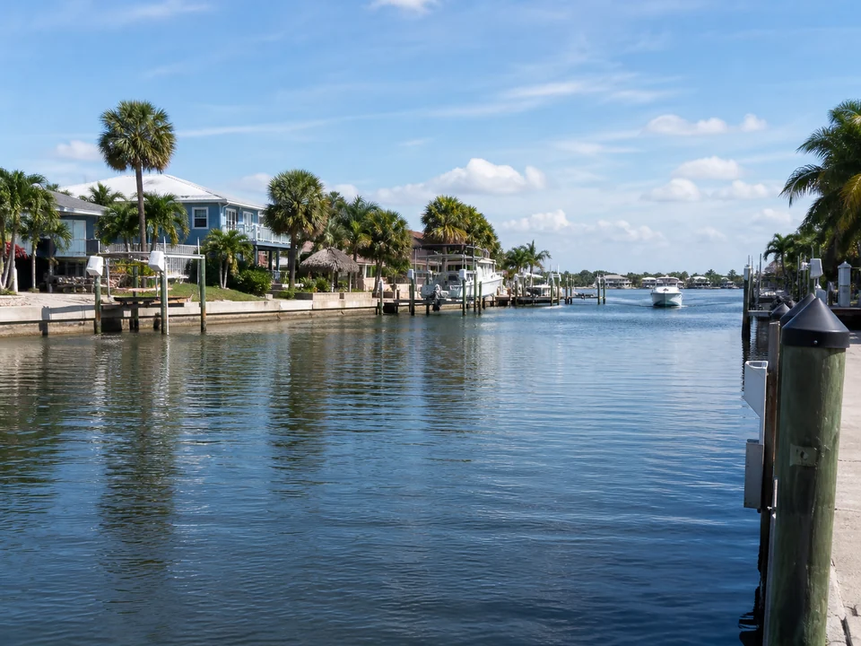
The barrier island has two different water facing contexts
Indian Rocks Beach sits between the Gulf of Mexico and the Intracoastal Waterway known as the Narrows. A Gulf side parcel and a Narrows side parcel should not begin with the same assumptions about shoreline form, vessel access, exposure, or the structure involved.
The Gulf and Intracoastal sides of Indian Rocks Beach involve very different shoreline, exposure, navigation, and environmental conditions. Our experienced waterfront contractor will verify the lot and water setting before determining which services, specialists, and review requirements are relevant.
Gulf exposure and Narrows access lead to different questions
The Gulf side can place beach, dune, wave, and coastal resource questions near the center of the discussion. The Narrows side is more likely to focus on docks, lifts, seawalls, tidal access, navigation, neighboring structures, and limited back yard staging.
These are community level decision differences, not diagnoses. If possible, photograph the broad water setting and note whether the visible concern changes with tide, wind, boat traffic, rainfall, or use.
Match the Indian Rocks Beach condition to the service path
On a Narrows side property, wall movement, soil loss, or end transitions can begin with seawall evaluation; dock components and connections can begin with dock repair; lift operation and vessel fit can begin with boat lift evaluation. A changing natural or armored shoreline can require shoreline stabilization questions.
On a Gulf side property, do not assume that a seawall, beach, dune, or erosion response is interchangeable with an Intracoastal solution. The property, resource setting, and governing requirements need a specific review, which the local professional will handle.
Why an Indian Rocks Beach project may involve more than one office
Indian Rocks Beach publishes local land development and zoning information, while city material directs specified building permit activity through Pinellas County Building Services. Pinellas Water and Navigation can add another waterfront layer for specified work.
Waterfront work may involve city, county, Florida, or federal review, depending on the property and proposed footprint. The local contractor will verify the waterbody, existing records, environmental resources, and current agency requirements before relying on any permit or exemption statement.
Official resources: Indian Rocks Beach permit information, Pinellas docks and waterfront review, and Florida environmental permitting.
How flood information can help you prepare
The City publishes flood hazard resources, but a general flood page cannot establish the elevation, construction requirements, or design for a specific property. When survey or elevation information is needed, your contractor will explain what records are useful and coordinate the appropriate surveying or engineering work.
Record drainage paths, low areas, recurring ponding, floor or yard elevation changes, and how proposed access can interact with the lot.
Constrained lots change how work can be approached
Narrow side yards, neighboring docks, utilities, seawall transitions, existing pools or patios, and limited land side reach can affect staging. Water side access can depend on depth, navigation, tides, equipment, and authority limits.
A written proposal by the contractor should identify the intended approach, material movement, protection of adjacent areas, exclusions, and which items remain subject to engineering, environmental, survey, or permit confirmation.
Use related pages to prepare the right question
Review the Pinellas waterfront guidance, compare shoreline, seawall, dock, and boat lift services, and use the homeowner guides to prepare for warning sign, permit, cost, and estimate questions.
Keep the first request concise: property location, Gulf or Narrows side when confirmed, affected structure, visible change, access constraints, and available records.
Frequently asked questions
Why does the Gulf or Narrows side matter in Indian Rocks Beach?
The two sides differ in water setting, exposure, resource context, vessel access, shoreline form, and common structures. Confirming the side prevents an Intracoastal assumption from being applied to a Gulf facing property.
Who handles building permits in Indian Rocks Beach?
City materials identify a city land development review role and direct specified building services through Pinellas County. Waterfront work can also involve Pinellas Water and Navigation and other authorities. The local contractor will handle this for you.
Can flood information determine the design for my property?
No. General flood information is a starting point. Property elevation, survey data, structure, scope, and current technical requirements need separate confirmation.
What access details should I document?
Photograph side yards, gates, utilities, patios, pools, neighboring structures, dock approaches, and the broad water side route from stable locations.
Can the page tell me whether repair or replacement is required?
No. That decision depends on a site evaluation, measurements, existing records, professional findings, desired use, and the scope of the job.
Information reviewed August 2026. Permit and regulatory information was checked against current official sources.